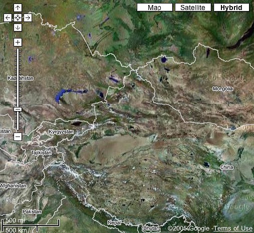
This image shows much of Central Asia, including Tibet, Nepal, Bhutan, Mongolia, Tuva, Altai Republic, Khakassia and the Stans of the former USSR.
Seeing these satellite images gives an interesting perspective on the regions of central Asia that include most major throat-singing centers.Click on the thumbs to see a large version.
This image shows much of Central Asia, including Tibet, Nepal, Bhutan, Mongolia,
Tuva, Altai Republic, Khakassia and the Stans of the former USSR.
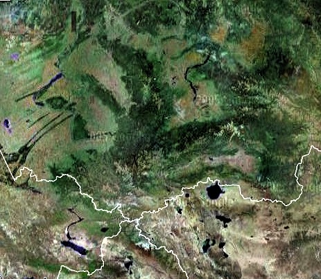
Altai Republic, Tuva, Khakassia, and NW Mongolia, all throat-singing regions.
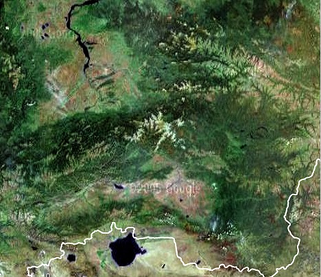
Tuva and very NW Mongolia. The white line marks the border between Tuva and
Mongolia.
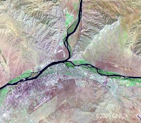
The Confluence of the Kaa-Xem and B'eg-Xem rivers, forming the Yenisei (flowing
W, to the left, then N to the Arctic Ocean. The capital of Tuva, Kyzyl is just
below the confluence.
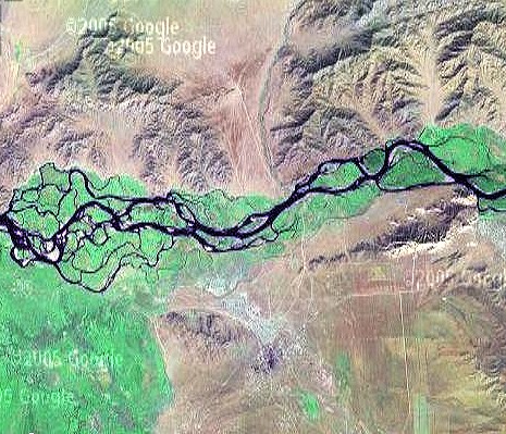
This shows the many channels of the Yenesei River, just east of Shaggonar
and the large reservoir created by damming the Yenesei. The sacred Bear Mountain,
or Xairakan, appears right center.
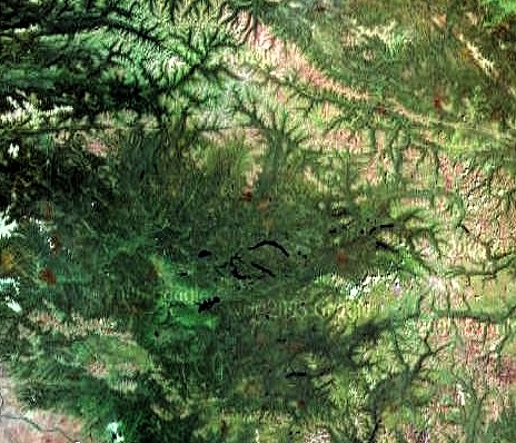
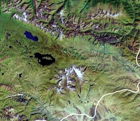
Todzha, the NE section of Tuva. It is filled with lakes and rivers, much wetter
than more arid western and southern Tuva.
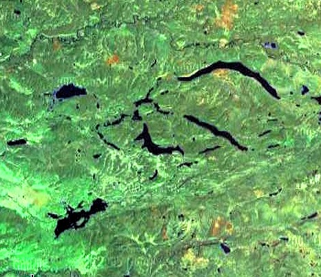
A closeup of the lake region of Todzha district in NE Tuva
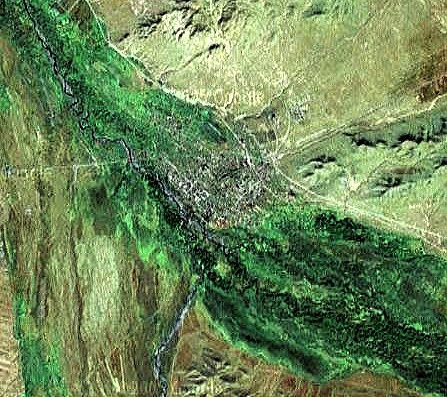
The area around the city of Chaadana
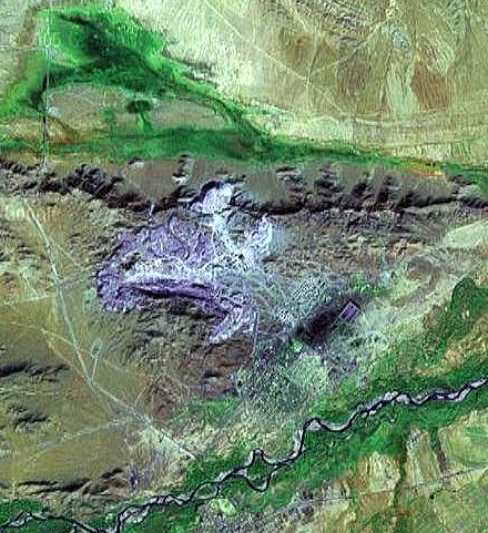
The huge open-air asbestos mine which looms over the town of Ak-Dovurak.
SW Tuva, with Mongun Taiga near center
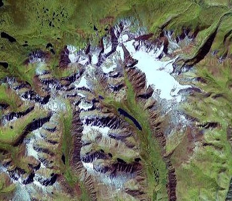
Mongun Taiga, the highest point in Tuva. Elevation is about 3970 meters, over
15,000'.
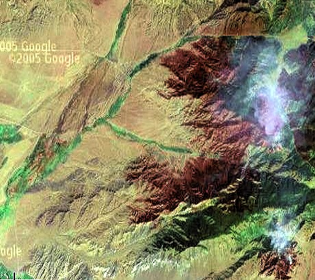
The area around Samagaltai, in southern Tuva, mentioned in several Tuvan songs.
The plumes are from forest fires.
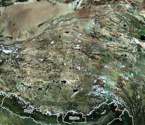
The Tibetan plateau
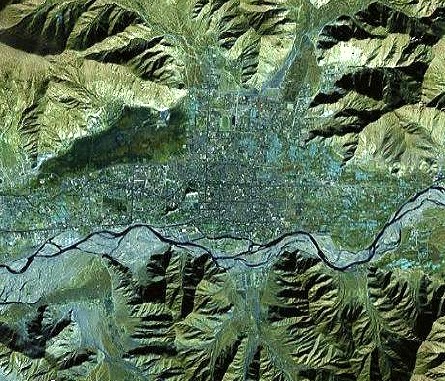
Lhasa, capital of Tibet and home to many monasteries. You can see the Potala,
traditional palace of the Dalai Lama, just left of center.
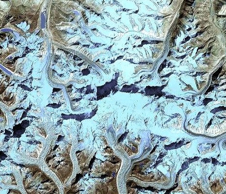
Mt. Everest. The border of China (Tibet) and Nepal runs directly along the summit.
The highest peak on Earth, its elevation is 29,035' (8850m) Its name in Nepal,
Sagarmatha (goddess of the sky) In Tibet:Chomolungma (mother goddess of the
universe).